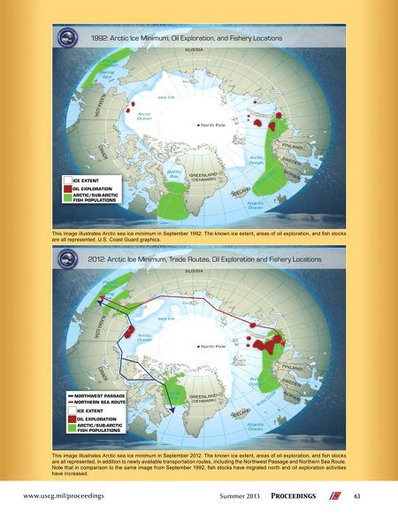
This image illustrates Arctic sea ice minimum in September 1992. The known ice extent, areas of oil exploration, and fsh stocks
are all represented. U.S. Coast Guard graphics.
This image illustrates Arctic sea ice minimum in September 2012. The known ice extent, areas of oil exploration, and fsh stocks
are all represented, in addition to newly available transportation routes, including the Northwest Passage and Northern Sea Route.
Note that in comparison to the same image from September 1992, fsh stocks have migrated north and oil exploration activities
have increased.
www.uscg.mil/proceedings
Summer 2013
Proceedings
63